Independent Aerial Triangulation and Orthorectification of UltraCam Condor 4.1 Imagery
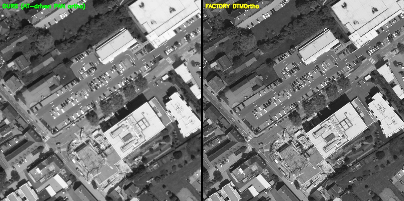
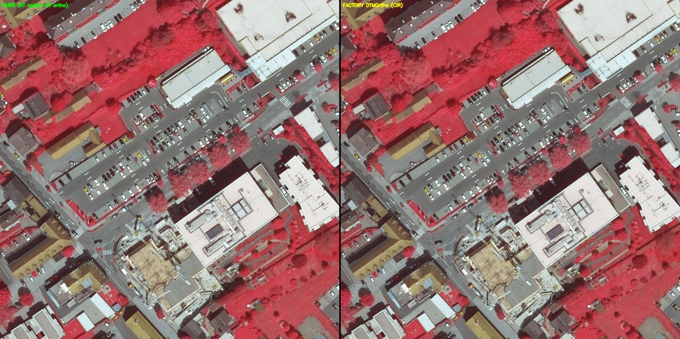
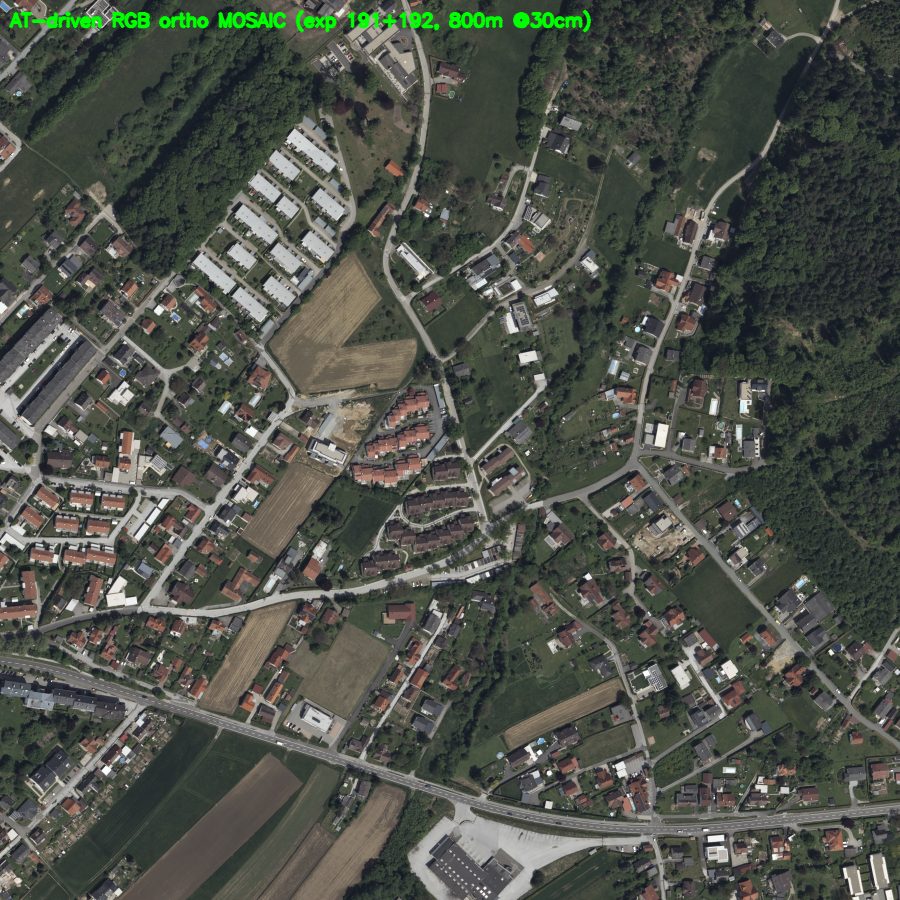
A free-network self-calibrating bundle adjustment of 48 UltraCam Condor 4.1 panchromatic exposures, computed from the raw GNSS/IMU trajectory, automatically extracted tie points, and surveyed ground control, attains an image-space standard deviation of unit weight of 0.93 px and a fitted-control ground RMS of 0.044 / 0.042 / 0.053 m (X/Y/Z), against the manufacturer's 1.87 px and 0.152 / 0.242 / 0.096 m. The imagery is orthorectified directly from the solution; the panchromatic orthophoto co-registers to the manufacturer orthophoto at NCC 0.95 (0.37 m residual, invariant to output ground sample distance), with absolute accuracy of ≈0.05 m at ground control. The colour-infrared orthophoto matches the factory CIR at NCC 0.91, and a nearest-nadir two-exposure RGB mosaic fills the block without visible seam.
1. Data
48 panchromatic exposures over four lines, Gleisdorf, Austria; Level-03 product 20488 × 14040 px, f = 123 mm; EPSG:25833. Inputs: the raw Applanix GNSS/IMU trajectory, the Level-03 imagery, and 12 surveyed ground control points (σ 0.05 H / 0.07 V), of which 8 fall on the processed subset. The manufacturer reference (UltraMap v6.8) and the factory DTMOrtho product are used for comparison only. The delivered Condor 4.1 Gleisdorf dataset is public.
2. Aerial-triangulation accuracy
| Metric | AG2IIndependent | Manufacturer |
|---|---|---|
| Image σ₀ (std. dev. of unit weight) | 0.93px | 1.87 px |
| Fitted-control ground RMS (X / Y / Z) | 0.044 / 0.042 / 0.053m | 0.152 / 0.242 / 0.096 m |
| Direct georeferencing, no adjustment (X / Y / Z) | 2.160 / 1.326 / 5.859m | — |
| Interior orientation | self-calibrated | factory |
The fitted-control ground RMS is lower than the manufacturer's on all three axes at half the image σ₀. Leave-one-out cross-validation gives 0.181 / 0.232 / 0.235 m (X/Y/Z) after removal of one surveyed-height blunder; the vertical figure is shown to be bounded by sparse-control sampling rather than a recoverable systematic.
3. Orthorectification
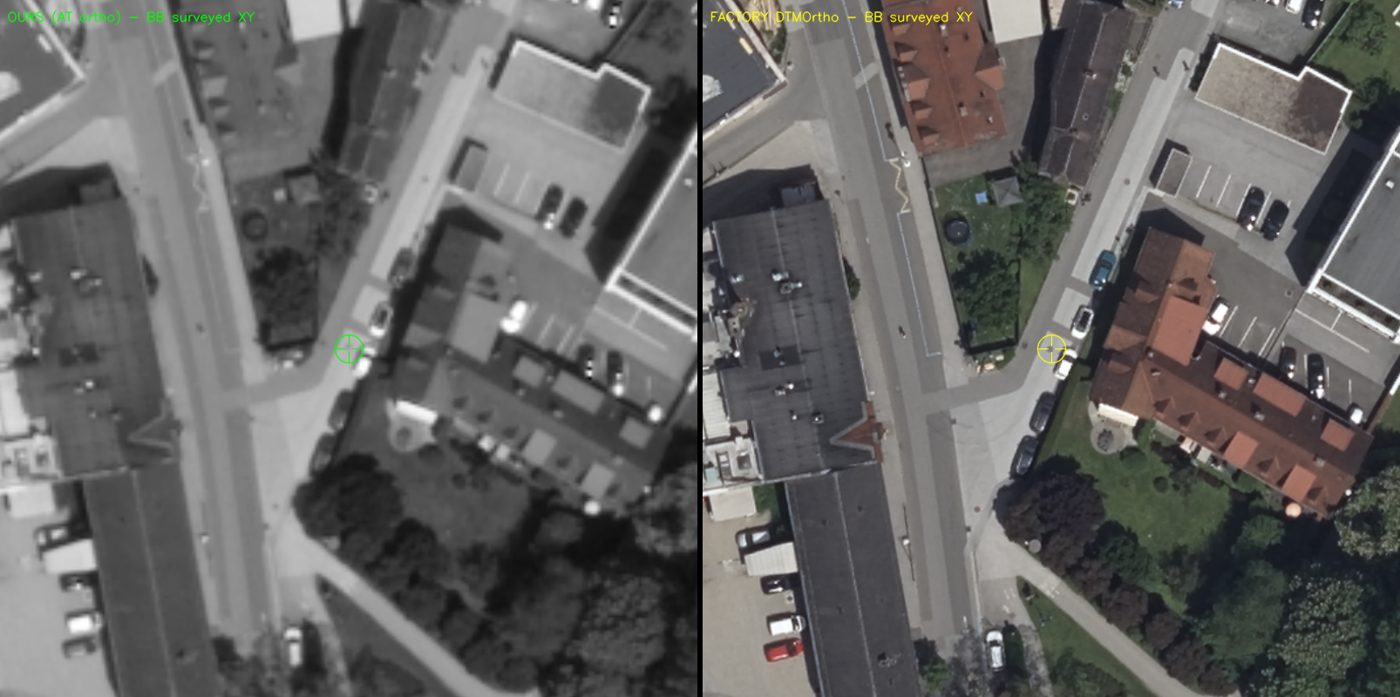
The imagery was orthorectified directly from the bundle solution and co-registered against the manufacturer DTMOrtho by phase correlation. Near nadir the panchromatic orthophoto co-registers at NCC 0.95 with a residual shift of 0.37 m; the shift is invariant to output GSD (0.37 m at 0.30 m, 0.36 m at 0.15 m), indicating a difference between the two independent solutions rather than a resampling artefact. The orthophoto's absolute accuracy, set by the AT, is ≈0.05 m at ground control, below the comparison residual.
4. Self-calibration
The bundle adjustment estimated a focal length of 123.051 mm (+50.7 µm relative to the 123.000 ± 0.002 mm certificate) and a principal point of (−2.24, −1.41) px on the Level-03 product grid. These terms are consistent with the 2.37× Level-03 resampling onto the 8.894 µm product grid rather than a calibration disagreement.
5. Report
The full technical report is available on request: contact AG2I.
Study data: Vexcel UltraCam Condor 4.1 — Gleisdorf, Austria (delivered dataset, public). Contact: info@ag2i.ai.