Automated Harvesting and Convolutional Classification of Road-Marking Training Data from HD-Map Vectors
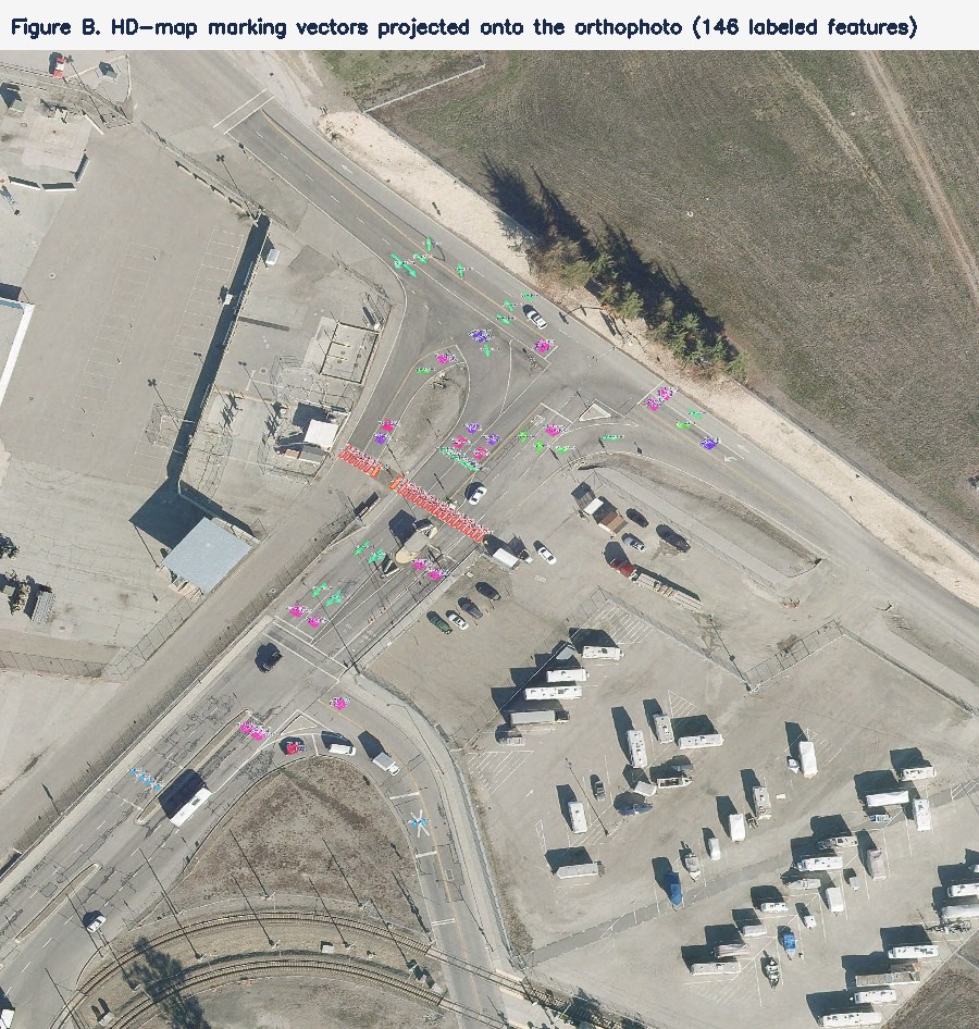
A road-marking training set was generated without manual annotation by projecting HD-map road-marking vector layers onto a co-registered nadir true-orthophoto (0.076 m ground sample distance) and cropping one image chip per feature, labelled by the feature's coded class attribute mapped to the OpenFeatureX catalogue. From 13,633 polygon and 47,483 line features, 15,000 chips were retained across 26 classes. A four-block convolutional classifier attains top-1 accuracy 58.6 %, mean per-class recall 62.6 %, and mean per-class precision 53.1 % on a held-out split — and 56–95 % on whole road scenes. In a controlled ablation — identical resolution, data, and schedule, varying only the network head — replacing global average pooling with a 4 × 4 spatial head raises top-1 from 49.7 % to 58.6 % and right-turn-arrow recall from 28 % to 65 % (left arrow 45 % to 70 %), isolating chirality — the mirror relationship between left and right arrows that pooling cannot resolve — as the dominant prior error; 18 of 25 classes improve. Labelling effort was zero.
1. Data
- Imagery. Nadir true-orthophoto at 0.076 m ground sample distance; three-band; geographic coordinate reference; 354,150 × 185,881 px.
- Labels. Two co-registered HD-map vector layers — a road-marking polygon layer (13,633 features: arrows, word markings, crosswalks) and a road-marking line layer (47,483 features: longitudinal line types). Function and Class are stored as integer codes and decoded through the source coded-value domains.
- Annotation. None. The HD-map vectors are the labels.
2. Method
Harvesting. Integer Function/Class codes were decoded through the source domains and mapped to OpenFeatureX catalogue codes. Each feature was reprojected to the orthophoto coordinate reference. Polygon features were cropped at their envelope (+30 %); line features in a fixed 4 m window centred on a mid-line vertex. Chips were resized to 96 px. A 1,000-per-class cap bounded over-represented classes. Retained: 15,000 chips across 26 classes.
Network. A four-block convolutional network (32–64–128–128 channels, batch normalisation, max pooling). The head replaces global average pooling with a 4 × 4 adaptive-average spatial map before the linear classifier. Global average pooling is invariant to translation and orientation but discards spatial arrangement — and arrangement is exactly the discriminator for arrow chirality (left versus right), word letter layout, and line dash patterns, so a coarse spatial map is retained.
Training. Stratified 80/20 split (train 12,007, validation 2,993), held fixed. Augmentation: cardinal and ±45° rotation (no mirroring, which would invert arrow chirality), scale 0.82–1.18, brightness/contrast jitter, and a 30 % chance of Gaussian blur. Class-balanced sampling; Adam at 1.5×10⁻³ with cosine annealing to zero, weight decay 1×10⁻⁴, label smoothing 0.1, 30 epochs, cross-entropy loss.
3. Results
A controlled ablation — chip resolution, data, and training schedule held fixed, varying only the network head — of a 4 × 4 spatial head against global average pooling, both at 96 px on the same held-out split, so each difference is attributable to the head alone:
| Metric | Spatial 4×4 head96 px | Global avg pool96 px |
|---|---|---|
| Right-turn-arrow recall | 65% | 28 % |
| Left-turn-arrow recall | 70% | 45 % |
| Top-1 accuracy | 58.6% | 49.7 % |
| Mean per-class recall | 62.6% | 53.6 % |
| Mean per-class precision | 53.1% | 42.1 % |
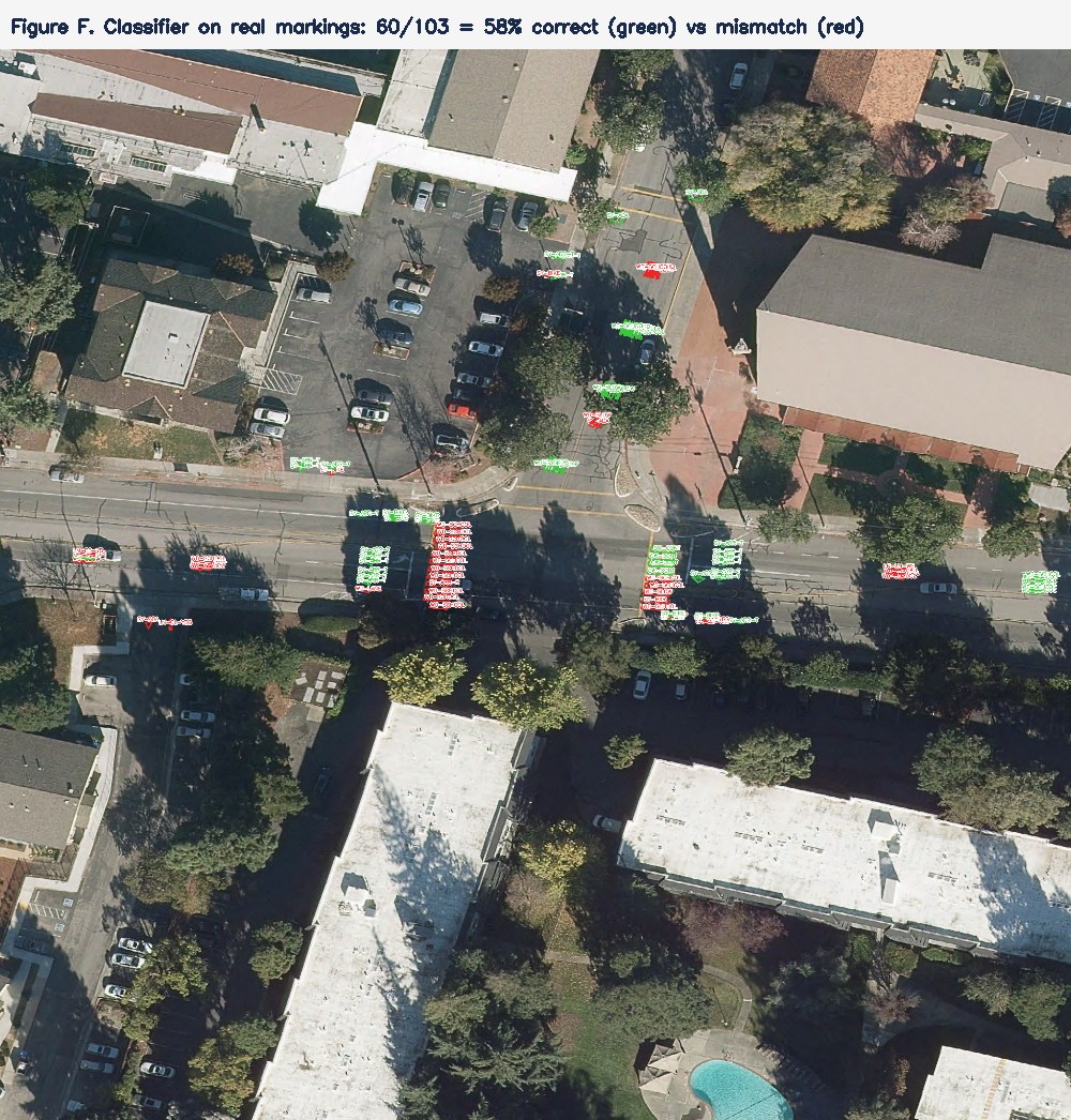
Global average pooling collapses the final feature map to one vector per channel, discarding where each feature lies; the spatial head retains a 4 × 4 grid. The effect is largest exactly where arrangement is the discriminator — the arrows — and 18 of 25 classes improve. Evaluated whole, five contiguous road scenes classify at 56–95 %, higher than the uniform-class validation figure because crosswalks and lane lines, the most frequent markings on real roads, classify well.
4. Confusion structure
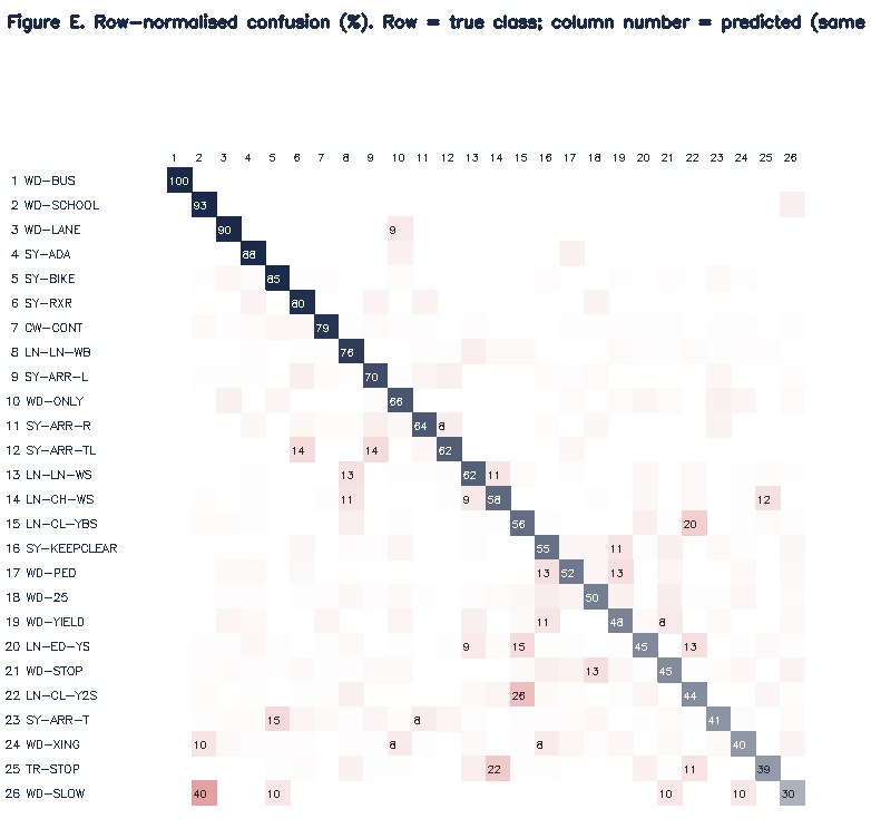
With chirality addressed by the spatial head, the residual error concentrates in three structured mechanisms rather than diffuse noise: (i) shape similarity — the through arrow taken for the bicycle symbol, both elongated forms at 0.076 m; (ii) short-word ambiguity — speed legend↔STOP, SLOW↔SCHOOL, ONLY↔STOP, short white words on dark asphalt at this resolution; and (iii) line-type pairs — broken↔solid white and double↔broken yellow, which differ only in dash pattern. The structure localises the next improvements — higher resolution for words and dash patterns — rather than requiring more data alone.
5. Conclusion
Decoding and projecting two HD-map road-marking vector layers onto a 0.076 m orthophoto produced 15,000 labelled chips across 26 classes with no manual annotation. A four-block convolutional classifier with a 4 × 4 spatial head attains top-1 58.6 %, macro recall 62.6 %, and macro precision 53.1 % on the held-out split, and 56–95 % on whole road scenes. A controlled ablation isolates the network head as the cause: the spatial head resolves the arrow-chirality error that global pooling caused (top-1 49.7 % → 58.6 %, right-arrow 28 % → 65 %), with 18 of 25 classes improving. The residual error is structured — shape-similar forms, short-word ambiguity, dash-pattern line pairs — which localises the next improvements. The procedure is annotation-free and scales with HD-map coverage.
6. Report
The full technical report is available on request: contact AG2I.
Training Dataset One. Source: HD-map road-marking vector layers and a co-registered nadir true-orthophoto. Contact: info@ag2i.ai.