The AG2I Voxelite™: a Photoreal Control Surface for HD-Map Ground Truth
The AG2I Voxelite™ is an orthophotograph fused with its own elevation surface and stored as a single four-band raster — red, green, blue, and elevation at every pixel. Generated from an aerotriangulated aerial survey, it carries a known, control-based accuracy, and on that basis serves as a control surface: a certified spatial reference to which other datasets are registered. Datasets brought to it — an HD-map vector set, a mobile-LiDAR point cloud collected without ground control — inherit the reference accuracy to within the measured registration residual, and the collection becomes a single conformed stack in one frame. This study assembles three such layers over one urban intersection in OpenGlobe and sets out the registration, validation, and certification sequence by which disparate datasets are brought to a certified control surface.
1. The AG2I Voxelite primitive
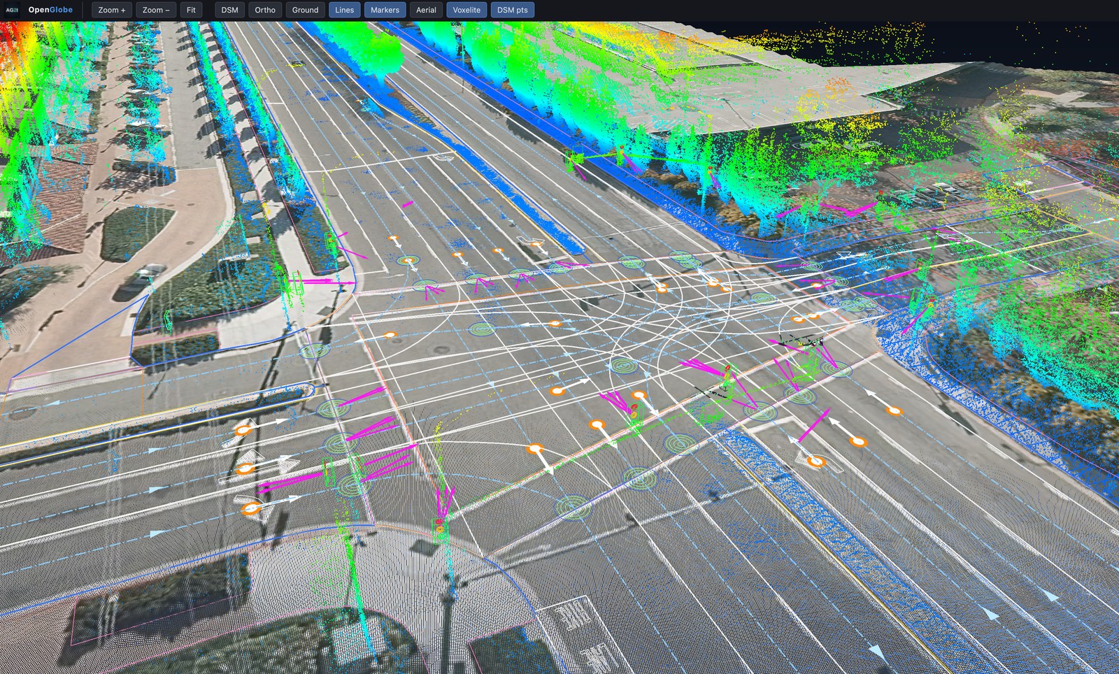
An AG2I Voxelite stores, per pixel, the three colour bands of an orthophotograph and a fourth band giving the surface elevation at that pixel. Position is given by the raster geotransform; the coordinate system is embedded. Viewed from directly above it is an orthophotograph; viewed obliquely it is a colourised surface model with photographic texture on every cell. It is generated from the digital surface model and true-orthophotograph of a photogrammetric survey and is gap-free. The surface is 2.5-dimensional — one elevation per ground position — which is what a road is, and what keeps it light enough to tile a road network. Three-dimensional scene content — LiDAR returns, poles, signals, signs — stands above the surface in true position, and the surface supplies their spatial and photographic context.
2. The control surface
Because a Voxelite is a certified product whose accuracy is known, it serves as a control surface: a certified reference to which other datasets are registered. OpenLineWorks matches a disparate dataset to the Voxelite by dense feature correspondence and warps it onto the reference frame — a process we call control transfer. A dataset brought to control inherits the reference accuracy to within the measured registration residual; registered to one common surface, a set of otherwise disparate datasets becomes a single conformed stack. On production orthophotography, control transfer has removed gross misregistration of 1.18 m and 14.8 m (mean) between public imagery and high-accuracy aerial references, each from more than 600 automatically matched control points.
3. One intersection, three layers
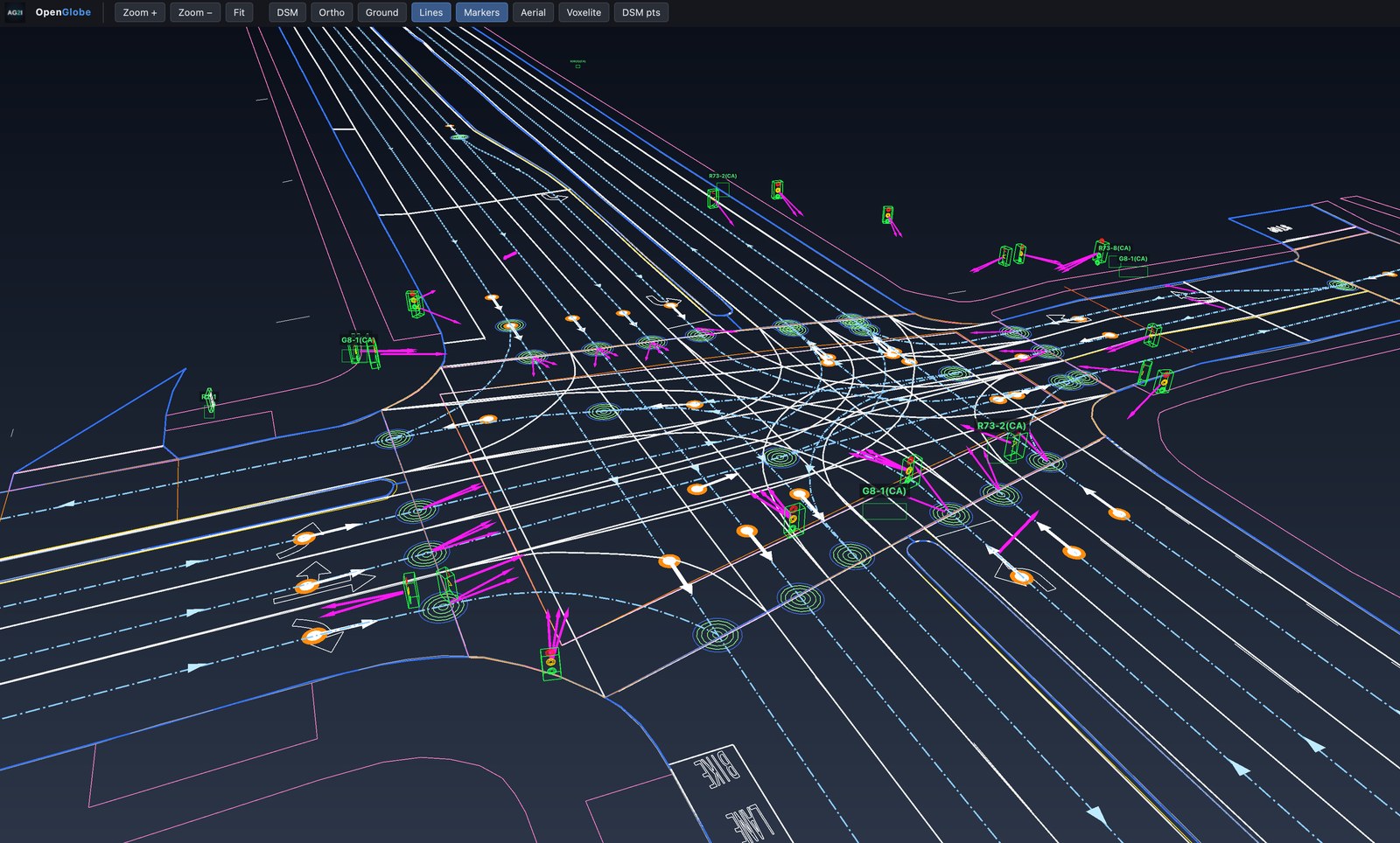
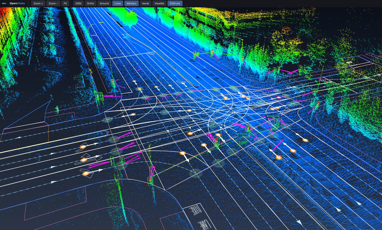
The sequence below assembles a single urban intersection in OpenGlobe. The HD-map data and the mobile LiDAR are referenced to the Voxelite with OpenLineWorks, taking it as their certified control, so the three layers resolve into one common, ground-truthed frame.
4. Register, validate, certify
The order is fixed: a dataset is registered to the Voxelite, validated against it, and certified — in that sequence — before it is relied upon. Once a dataset is registered, the whole of it moves as one. Not only the point cloud and the map vectors, but every feature drawn from them — including the signs and signals auto-extracted from the otherwise inaccurate mobile LiDAR — is carried by the same transform into the certified frame. Every feature and layer moves together.
5. Report
The full technical report is available on request: contact AG2I.
Study data: an aerial-survey Voxelite, an HD-map vector set, and an uncontrolled mobile-LiDAR survey over one urban intersection. All spatial results in metres. Contact: info@ag2i.ai.