Surface-Model and Orthophoto Geometry of the UltraCam Osprey 4.1 Barcelona-Beach Set
The Vexcel UltraCam Osprey 4.1 Barcelona-Beach delivery is a compact coastal product set — digital surface model (DSM), digital terrain model (DTM), and seam-lined DTM-orthophotos in RGB and colour-infrared — captured June 2021 at 7.5 cm nominal ground sample distance from 1 550 m above ground. All five rasters share one 8 cm grid in EPSG:32631 (UTM 31N) over a 0.443 km² scene. The terrain is near sea level (DTM mean 2.2 m) while the DSM rises to 49.5 m over the built front; the normalised surface reaches a 45.2 m maximum object height with ≈23 % of the scene above 0.5 m. A bridge-removed DTM variant carves bridge decks from the terrain (1.84 m maximum removal) so the orthophoto drapes continuous water beneath them. The set is gap-free and geometrically clean, and serves as a coastal reference product for multi-site benchmarking against an independent processing pipeline.
1. Dataset and delivered products
UltraCam Osprey 4.1 (f120), Barcelona Beach, Spain, June 2021; 1 550 m above ground, 7.5 cm nominal GSD, 80 % forward / 60 % side overlap; processed in UltraMap v6.6; EPSG:32631 (WGS 84 / UTM 31N). The delivered grid is 11 264 × 6 144 px at 0.08 m → 901 × 492 m (0.443 km²). Every raster shares one georeferenced grid, so the DSM, DTM, and the two orthophotos overlay pixel-for-pixel; the ortho products carry full overview pyramids, indicating they are intended for interactive serving.
2. Surface models
| Model | Min / Max | Mean / Std |
|---|---|---|
| DSM | −1.48 / 49.54m | 4.91 / 7.32 m |
| DTM | −1.30 / 8.77m | 2.22 / 2.01 m |
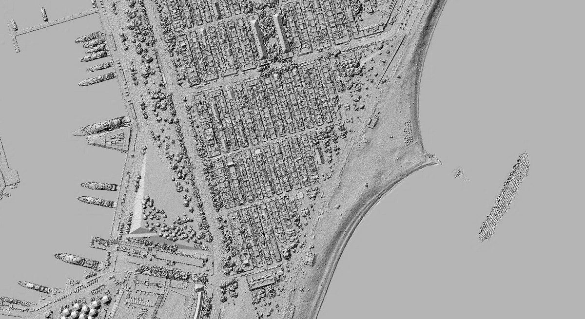
The DTM describes a near-flat coastal plain with sub-zero minima over the shoreline margin, while the DSM carries the built and vegetated canopy to ≈50 m. Both models are gap-free (100 % valid). The normalised surface (nDSM = DSM − DTM) has a 45.2 m maximum object height; ≈23 % of the scene exceeds 0.5 m and ≈12 % exceeds 10 m — the building front — with the remaining four-fifths the beach, esplanade, water, and road surface. The gap-free DSM/DTM pair makes the set a clean reference for nDSM-driven workflows such as obstruction and building extraction.
3. Orthophoto products
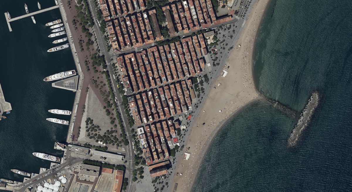
The RGB and CIR DTM-orthophotos are 8 cm three-band byte rasters rectified onto the DTM and seam-lined into a single mosaic; an accompanying seam-line raster records the per-pixel source-image partition. Because both are rectified to the same DTM and grid, RGB and CIR are mutually registered, and the colour-infrared product supports vegetation and water discrimination over the same footprint.
4. Bridge-removed terrain variant
The delivery includes a parallel bridge-removed set — a DTM and RGB/CIR orthophotos, but no DSM. Differencing the two DTMs localises the edit to the bridge and footbridge structures over the water channel, with a maximum vertical removal of 1.84 m. Carving the deck out of the DTM is the hydro-correct treatment: a DTM-orthophoto rectifies imagery onto the terrain, so a bridge left in the DTM would lift its pixels and tear the water surface, whereas removing it lets the mosaic drape continuous water beneath the span. The DSM is intentionally withheld from this variant because the surface model, by definition the top reflective surface, must retain the bridge — an explicit statement of the surface-versus-terrain contract that any orthorectification engine must honour.
5. Reference role
Unlike the raw UltraCam blocks that drive independent aerial triangulation, this Osprey delivery is a finished-product reference: there is no raw imagery or block orientation, only the rectified deliverables. Its value is as an external accuracy and product-geometry benchmark — a small, gap-free, dual-variant set against which an independent DSM/DTM/ortho pipeline can be compared for elevation agreement, mosaic seam behaviour, and bridge/hydro handling — and as a near-flat coastal counterpoint to the high-relief inland references in the same multi-site series.
6. Report
Product-reference report (PDF, 3 pp)
Study data: Vexcel UltraCam Osprey 4.1 — Barcelona Beach, Spain (delivered product set). Contact: info@ag2i.ai.